In preparation for a field trip to see and view a few deep-seated bedrock landslides, I pulled up a lidar image of one of the roads we are heading up in order to view another slide. The route takes is into an area that appears to have some slide features as well as a rather fractured looking slope.
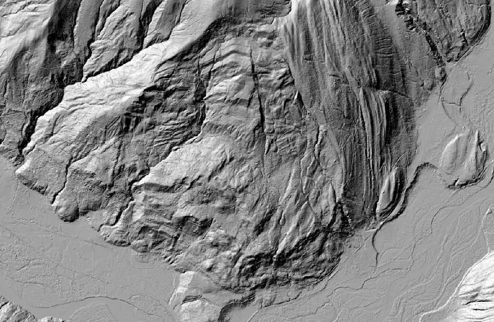
Lidar image of south end of Sumas Mountain in Whatcom County
Nooksack River valley floor is in the bottom of image
Noted fluted landscape on the east portion of mountain that is a combination of glacial action combined with resistant sandstone beds of the Chuckanut Formation

Geology map of the area by Dragovich and others (1997)
Geologic Map and Interpreted Geologic History of the Kendall and Deming 7.5-minute Quadrangles, Western Whatcom County, Washington
Dragovich and others (1997) mapped an area between two distinct surface fractures as a landslide. However, the lidar imagery suggests the slide complex extends further west. A later map by Lapen (2000) included the larger slide area.
I have not assessed this slide complex, but did walk along the east limb of the slide on an unrelated assessment associated with a debris flow hazard. A stream flows within the fractured east edge of the slide exposing a dip slope surface of the east side of the slide complex.


Complex topography and one one numerous mountainside deep bedrock failures to consider during our ventures and discussions.


No comments:
Post a Comment