Reviewing aerial images is a routine part of my work. Over time the images have become better and better with images over the past decade being of substantially greater resolution and detail compared to older images. And of course color images are more typical today than the black and white images up through the 1990s.
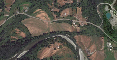
The set images below were taken in July 2015 and are of an area in western Washington. The timing of the images captures the window of time as grass pastures begin to dry out and grass goes dormant. The variability of drying out tells a story of the underlying soil.
Alluvial fan from creek coning out of a steep forest slope to the southeast
Old channels underlain by gravel have turned brown sooner than the areas underlain by silt
The interpretation was confirmed with test pits dug on the fan surface
Another fan, there may be some mowing and animal paths as well
Old river flow paths are obvious in the tree filled abandoned channels but are also evident in the soil.


No comments:
Post a Comment