Tuesday, September 30, 2014

Notes on Turtleback Complex and an Old Oak


Turtleback Complex

This bit of Turtleback Complex is from the southwest of Orcas Island. The Geologic Map of the Washington Portion of the Roche Harbor 1:100,000 Quadrangle, Washington (Logan, 2003) indicates the bedrock where this sample was picked up is pre Devonian intrusive rocks of the Turtleback Complex. Much of the Logan (2003) map in the vicinity of the property is derived from mapping and rock descriptions of Vance (1975). Logan notes a lead/uranium date from a tonalite rock sample collected near Steep Point on the southwest of Orcas yielded an age of 405 million years, but dates as old as 554 million were reported by Whetten and others (1978). There is a fair bit of variety of igneous intrusive rock types within the complex. The age date range and variety of igneous rock types suggests the complex is an ancient and long lived root of a volcanic center.

The Turtleback Complex was likely a much more extensive volcanic arc and has been postulated as being related to similar aged and type rocks in the Northwest Cascades, the Yellow Aster Complex, and possibly scattered elsewhere in Oregon and northern California. Those linkages will take some more work to be confident of. The Turtleback is part of one of several tectonic terrains in the Northwest Cascades System-San Juan melange. Units within the melange consist of a wide variety of low-grade to high-grade metamorphic rocks of various ages juxtaposed along now extinct tectonic fault lines, but the Turtleback Complex is part of the oldest. 

An extinct tectonic thrust fault juxtaposing Turtleback Complex with the younger Orcas Chert is located relatively close to this outcrop. 

My typical experience with the Turtleback Complex is that it has been statically metamorphosed with no strong fabric or shear zones present within the bulk of the formation.  The lack of metamorphic fabric is a bit deceptive as many of the minerals have been recrystallized and Vance (1975) describes two separate metamorphic periods.

Just where the Turtleback igneous rocks formed and how they arrived to where they did is a complicated challenge. These igneous rocks did not intrude into the San Juan Islands, but were part of some ancient collision between North America and an off shore terrain. And even after collision, further faulting and movement likely took place with a variety of interpretations. A tough puzzle to solve.

The Turtleback Complex is named from Turtleback Mountain on the north of Orcas turtleback-looks--a-like-turtle.

Besides my rock find I came across the thick skin of a Garry oak on the dry slope. These oaks are not rare on Orcas. But they are scattered and are much less common than the extensive oak forest stands in the south parts of Washington State.

Thick bark of a mature Garry oak

Garry oak trunks and the thin red barked Pacific madrone 

Sunday, September 28, 2014

"Usual and accustomed grounds", Coal Terminals - Lummi Message is Clear

Mr. Ballew's article: 

message
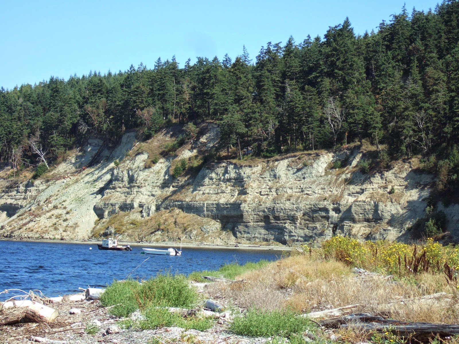
Thousands of years ago, canoes hand-carved from cedar trees skimmed across the waters of the Puget Sound and its tributaries, powered by the paddles of fishermen whose skills were passed from generation to generation. Below them swam an abundance of salmon, enough to feed and sustain generations of Lummi people.
Today our people, the Lhaq’temish or People of the Sea, navigate the same waters our ancestors crossed to fish and share the lessons of survival, culture and history. We have worked, struggled and celebrated life on the shores and waters of our homeland for thousands of years. In 1855, our leaders signed the Point Elliott treaty in exchange for ceding lands to the U.S. government. This reserved existing inherent rights to hunt, fish and gather throughout our usual and accustomed grounds, stations, traditional territories and homeland territory, which includes our present-day reservation. Our past leaders, seeing the encroachment on our lands and way of life, had the foresight to fight to preserve the lifeblood of the Lummi people — our right to fish. As the largest native fishing fleet in the nation, with approximately 700 registered fishers, we have exercised these rights and continue to defend and protect them to this day.
The decisions we make ensure that our Schelangen, our way of life, lives well beyond us. It was unimaginable to our ancestors that there would come a time when the salmon runs were not thick and teeming with enough fish to feed the village through every season. Today, the salmon are far fewer and our community is forced to deal with a changing landscape, and new environmental dangers and challenges.
The Lummi Nation, as a self-governing and sovereign nation, is committed to our responsibility to the land, economy and community, both now and for future generations. We believe in a thriving and healthy community for everyone.
That’s why the Lummi Nation opposes a new coal export terminal at Cherry Point in Whatcom County. It poses too great a risk to the salmon so integral to our culture and way of being. Increased vessel traffic will interfere with fishing, and the proposed terminal and increased uses of anchorages will reduce access to fishing grounds. The large volumes of ballast water discharged by Cape-sized ships that would call on the terminal threaten to introduce invasive species that could destroy the fishery. And carbon balance impacts caused by burning coal will contribute to ocean acidification that threatens all North Sound fisheries.
Our sacred duty to protect the salmon and people is also why we are proceeding with great caution in conversations about the right path forward for the clean up of Bellingham Bay. The potential impacts on the ability to fish are not only critical to examine but required. Any activity, construction or changes in our shared waters and shorelines must protect the treaty fishing rights guaranteed us as a sovereign nation.
We are also partners and stewards in ensuring the health of our natural resources. We have created a wetland mitigation bank — an innovative means to ensure no net loss of wetlands or their functions, and to protect shellfish habitat and help restore salmon species. The bank allows individuals, governmental agencies and private companies, both Lummi and non-Lummi, to purchase credits to offset any unavoidable impact to our region’s wetlands.
As Lummi people, we are culturally linked to the waters, land and fish of our home. Our leaders have always created a path forward of subsistence and sustainability. They held sacred their duty to preserve our Schelangen, our way of life, for generations to come, and it’s a duty we continue to hold sacred through all the changes of our modern world.

Read more here: http://www.bellinghamherald.com/2014/09/28/3874993/lummi-concerned-for-environment.html?sp=/99/122/#storylink=cpy

Friday, September 26, 2014

Under the Columbia River Basalt Group

Columbia River Basalt capping older Miocene and Oligocene rocks

Lots of basalt covers much of eastern Washington south of the great bend in the Columbia River. The basalt is part of a large igneous province, one of the largest out pourings magma in the world. What is under all that basalt? 

On the north, one can get peaks along the thin parts of the Columbia River Basalt Group along the northern margin of the massive flows near the Columbia River. This includes a favorite spot HERE and an obscure but easy to visit spot on Highway 2 HERE. Both show essentially igneous rocks that extend to the north into the highlands across the north part of the state. 

On the west, a drive down along the Columbia River near Brewster will encounter similar rocks and closer towards Chelan one can see the a highly metamorphosed and very ancient accreted terrain that is an extension of the North Cascades (a future post). 

To the east the basalts thin south of Spokane and one can see the ancient former edge of North America. These rocks also show up deep in the Snake River canyon down stream of Lewiston, on the peak of Steptoe Butte (steptoe-butte) rising as a lone summit above the Palouse which is otherwise underlain by basalt and thick wind deposited silts, and hard to get to isolated outcrop on an island in a lake surrounded by basalt cliffs (bonnie-lake-precambrian-schist and more-notes-on-bonnie-lake-steptoe).    

To the south one has to head down into Oregon and into the deep canyon lands of the John Day region. In a way the rocks here are the most interesting as they preserve what the area was like before all the basalt flooded over the landscape. These rocks are full of plant and animal fossils from between 25 million and 15 million years ago before all the eruptions.

These fossil sites have been a treasure of information about the Miocene Oligocene and a lot of what we know of the period is from the Oregon sediments preserved under the Miocene age basalt of the Columbia River Basalt Group at the John Day Fossil Beds.

The National Monument provided a nice labeled picture of the same view I took.   


Of course the next question is Exactly where do the rocks seen around the west, north, east and south edges of the Columbia River Basalt Group meet under the basalt? 

Thursday, September 25, 2014

Pac-Man Aggregate Mining

I was doing some of my volunteer work on the Whatcom County Surface Mining Advisory Committee (SMAC). One of the issues we are dealing with is trying to balance the new goals and policy with the fact Whatcom County ended what the then county geologist referred to as Pac-Man (http://en.wikipedia.org/wiki/Pac-Man) mining

Pac-Man mining was a means of avoiding Department of Natural Resource mining and restoration permitting by keeping the size of the mine under 3 acres. After mining 3 acres, another 3 acres mine would start. In this way the mining would proceed with little bites across the landscape like the old Pac-Man game one bite at a time. The DNR via state code does not have to deal with little mine sites, but the language has allowed some mining to get around the intent of having large mines do reclamation plans.   

Counties can either ban this type of activity or take on regulating it themselves or ignore it all together as not of much concern. Pac-Man mining is still permissible in at least some other counties. I was digging a bit into the threshold level for a possible project that has some other issues as well and found the relevant state code language. 

RCW 78.44.031 (17)(a)

(17)(a) "Surface mine" means any area or areas in close proximity to each other, as determined by the department, where extraction of minerals results in:
     (i) More than three acres of disturbed area;
     (ii) Surface mined slopes greater than thirty feet high and steeper than 1.0 foot horizontal to 1.0 foot vertical; or
     (iii) More than one acre of disturbed area within an eight acre area, when the disturbed area results from mineral prospecting or exploration activities.


(5) "Disturbed area" means any place where activities clearly in preparation for, or during, surface mining have physically disrupted, covered, compacted, moved, or otherwise altered the characteristics of soil, bedrock, vegetation, or topography that existed prior to such activity. Disturbed areas may include but are not limited to: Working faces, water bodies created by mine-related excavation, pit floors, the land beneath processing plant and stock pile sites, spoil pile sites, and equipment staging areas. Disturbed areas shall also include aboveground waste rock sites and tailing facilities, and other surface manifestations of underground mines.


Saturday, September 20, 2014

Haul Road Repaired Below Ross Dam

I got a brief view of the rock slide below Ross Dam at the upper end of Diablo Lake diablo-lake-rock-slide. The slide area was repaired by knocking down the loose stuff and remaining precarious rock and rerouting the access road outward a bit.  
 
I happened to be taking in the view when the supply barge was pulling up to the upper end of the lake.

The logistics of managing the Ross Dam power house and dam present some challenges. The same applies to management of the lake above the dam. The road referred to as the Haul Road is not connected to any other roads. The narrow steep sided gorge limits access. Equipment, vehicles and materials must be barged up Diablo Lake downstream of Ross Dam and then transported on the Haul Road up to the dam or to Ross Lake above the dam. 

Wednesday, September 17, 2014

The Other Ice-Age Flood: Bonneville Flood


The highway through Lewiston, Idaho passes by a gravel cut slope with a retaining wall at its base to catch material that ravels off the slope. The cut slope is a deposit from an ice-age flood. But this flood was not derived from the rapid draining of ice-age glacial Lake Missoula. Instead this thick deposit of gravel was derived from a massive ice age flood when Lake Bonneville in northern Utah overflowed into the Snake River drainage in southern Idaho approximately 15,000 years ago. When Lake Bonneville over topped the pass at Red Rock, the resulting flow of water rapidly down cut a channel draining the lake down 350 feet.

The flood greatly altered the Snake River and areas along the river in Idaho and left a series of large gravel bars and terraces within and downstream of Hells Canyon including deposits along the lower Snake River in Washington State. It likely left a mark all the way down the Columbia River to the Pacific Ocean; however, the much more intense repeated ice age floods from glacial Lake Missoula obliterated most if no all the evidence. The Bonneville flood deposits a bit upstream of Lewiston were deposited over back water sediments from the Missoula Floods and in turn later Missoula Floods deposited backwater sediments above the Bonneville deposits. Tom Foster has a nice write up http://iceagefloods.blogspot.com/2010_05_01_archive.html with some great images from the Lewiston to Pittsburgh Landing area of the Snake River.


Tuesday, September 16, 2014

Grande Ronde Basalts at the Grande Ronde

The southeast corner of Washington State provides an opportunity to see the source area of some of the great flood basalt flows that cover much of eastern Washington. While there are plenty of impressive basalt cliffs and canyons in Washington State, the canyon land topography of the Hells Canyon and Grande Ronde River Canyons as well as tributaries gives an even better impression of  thickness of the basalt flows.

View down Rattlesnake Creek to the Grande Ronde River.

Basalt lined slopes of Rattlesnake Creek

A feeder dike can be seen just west of the Highway 129 bridge across the Grande Ronde River. Schuster's 1993 map of the area marks the dike as Grande Ronde basalt. 

Feeder dike of basalt cutting through older basalt flows in Grande Ronde canyon

The Grande Ronde basalts are the most extensive flows by area and by volume These flows extend all the way to the Spokane area and all the way to the ocean in southwest Washington. The Grand Ronde flood basalts make up somewhere on the order of 85 percent of the volume of the Columbia River Basalt Group.

Camp and Ross provide one take on the massive out pourings of basalt from the mantle plume camp.   The Grande Ronde basalt came out of some of the earlier dikes in the Chief Joseph dike swarm in northeast Oregon and southeast Washington. The name Chief Joseph is derived from the fact the area of the basalt feeder dikes is within Chief Joseph's beloved homeland before he and his group of Nez Perce were forced off their land.


Saturday, September 13, 2014

Porch Poodles, ISIL or ISIS and Scotland

I have been meandering about the Northwest so part of my landscape observations have been overprinted by more than the usual dose of news.  A political observer in my community once described the individuals making constant critical comments "porch poodles" - insistent that something is happening and something must be done but running away from taking any real action themselves. 

This bit of satire from Karl reMarks sums up my impression of the yak fest on ISIS or ISIL and Scotland.

Finally, and drawing from our collective experience as Middle Experts, we must stress that the US should not and must not continue its policy of non-intervention in the Scottish independence question. We must do something. Things must be done. There is a necessity for the doing of things. It’s also the point at which we normally ask the requisite rhetorical question near the end of the end: should we allow Scotland to exist as a small oil-rich country? (Like, do we need another Qatar now?) President Obama must avoid this by arming the Protestants. Or the Catholics.

The entire article is HERE.

More Washington Landscape stuff later.
 

Wednesday, September 10, 2014

Desolation

I took a trip up Desolation Peak as part of a group adventure with the North Cascades Learning Center. Desolation gained some fame from one its fire look outs - Jack Kerouac spent one summer watching for fires from the look out and wrote Desolation Angels from that period.
 
One of leaders was a former lookout Gerry Cook. It was great fun to be in the lookout with him and current lookout, Daniel.  
 
 
Some clouds were about while loafing on the summit, but we had a fine view of the other Skagit River delta where the river flows into Ross Lake near the U.S - Canadian border.
 
 
In the other direction Ross Lake looked fjord-like in its deep mountain valley.
 
Hozameen, a crazy steep peak to the north wore a hat all day long.


Daniel has a tradition of taking pictures of his guests.
The next day those clouds and their moisture became less stable and we picked up Daniel's message on the radio about lightning to the east.

Most of my field time and camping is not social and I do much of my field work alone. I very much enjoyed my temporary tribe and our adventures.


Wednesday, September 3, 2014

Silts and Slope Failures at Discovery Bay

Subtle variation in the geologic units on a bluff can make a big difference in how slopes fail. At this bluff in Discovery Bay, west of Port Townsend, the main driver is erosion at the base of the bluff by wave action. But how the bluff fails is important in terms assessing risk to sites above the slope.
 
A few notes on this view of the bluff. The trees on the slopes above the bare bluff are generally mature Douglas fir. Its a harsh growing environment so most of these trees are on the order of 80 years or older. The lower slope is pre last glacial period silts, clays and sands that are compact and resistant to erosion and stand vertical. The slopes above vertical bluff sections are far from vertical suggesting looser material. Indeed those slopes are underlain by mostly sand and gravel.  Note also the thick wedges of landslide debris at the base of the bluff. The one behind the boats is from a slide that took place in 1998. The one on the far left that covers the cliff face took place two years ago. 
 
 Closer view shows vertical fractures in the silt layers on the steep bluff
 
Chunks of silt spalled off the bluff face as brittle blocks 
 
But the same hard, brittle blocks turn to mush when wet. The wetting of the silt unit along the upper part of the steep bluff appears to be playing a role in upper bluff slope failures.

What had been a hard, dense, over-consolidated silt has dilated into weak silt incapable of supporting the units above. As this silt and clay collapses and falls apart the slope above of loose sand and gravel then pours down the slope. The process of the clay and silt units changing from hard compact material to highly fractured material and then soft mush is a feature of many larger landslide complexes. At this particular site the scale of the slides is relatively small perhaps because the zone of altered silts is fairly thin.