Monday, December 30, 2013

The Towers of Jump-Of-Joe

I've posted previous posts on Jump-Off-Joe. Jump-Off-Joe is a high point along the Horse Heaven Hills south of Kennewick. Although its elevation is nothing particularly exciting, it provides very long distant line of sight views deep into eastern Oregon and eastern Washington. As such the summit ridge of Jump-Off-Joe bristles with communications towers. And in recent years the entire ridge line has been lined with wind powered electric generators.


Whenever I view these facilities I suspect there is some lack of comprehension in my understanding of physics as I don't fully understand the various facilities.

Jump-Off-Joe is an old personal haunt. During a former era my mates and I would leave a car at the summit and then run from town up over the initial ridge line of the Olympic-Wallowa lineament, across the broad wheat plain and then up the brutal 1,000-foot steep slope to the summit. On a more ambitious venture, Billy and I ran to the summit and back, and held bragging rights only local long distance runners could appreciate.

One communication tower of diminutive stature still stands near the route that caused much burning pain in my thighs.

Small antenna just below the summit ridge

On a recent trip, I headed down the steep summit ridge to explore the slope. The steep slope has been routinely burning with a recurrence interval of every two years or so for the past couple decades. There is essentially no sage left. 

The slope is steep enough that Sam, who has gotten a bit long in years, prefers to let me do my thing without her assistance, but to her credit remained vigilant as I headed down the slope.

An alert Sam watching over me and the Pasco Basin

Sunday, December 29, 2013

Comanchie context to Yakama War

In order to gain some context on the Yakima War, I've been reading some other Indian histories from various other areas of the United States over roughly the same era 1830s through 1880s. The Yakima War took place in the mid 1850s.

I am currently reading Empire of the Summer Moon by S.C. Gwynne. This book covers the rise and fall of the Comanches - and fills a bit of a big gap in my understanding of U.S. history. Being rather provincial and never having lived or spent much time in Comanchera lands my understanding of that tribe and the bloodshed associated with the Comanches was a bit limited.

In a previous post I noted that Sheridan's first Indian battle was with the Yakama. Prior to that Sheridan had been in Texas to deal with Comanche raids, but his role was limited to scouting (and recreational hunting) and he never engaged in any battles. He did find a raiding party of Comanches which led to a military attack on the Comanche party.

A few take away notes on the Indian situation in what became Washington State relative to other White/Indian conflicts. Perhaps the mots impressive is that the Washington tribes really were peaceful relative to elsewhere - certainly compared to decades of violence or even centuries of violence on the plains. The Yakama War was a nasty business and very brutal, but it was short and though it left unresolved numerous issues those issues were later resolved fairly and unfairly without the violence that  other areas suffered. Disease played a big role in how various White/Indian conflicts played out. Fighting between Indian tribes and clans also was a key factor. Both of these played a role in the Pacific Northwest. The other key was economic situation. Pacific Northwest tribes had been engaged in trade with Whites for a half a century prior to the Yakima War. Early missionary work by Jesuits in Washington may have been significant - a Jesuit mission was located in the heart of Yakama territory by invitation of the Yakama. Military weapons and tactics of course played a huge role; in the case of the Yakama War, weaponry shifted greatly from the start to the late battles.

Perhaps what is surprising was the tactics used in the Yakama War by the U.S. Army were consistent with tactics later used by the military nearly 20 years later on the plains. Sheridan, Sherman and Mackenzie knew how to wage war and used the same methods on the horse Indians of the plains that had been applied to the Yakamas and Yakama allies in the mid 1850s. 

Friday, December 27, 2013

Locations of Towns

A fair bit of my professional work is associated with geologic hazards, but I (we) also do a fair bit of historic research as well associated with projects both as a consultant and on the public side.

This article(http://www.voxeu.org/article/are-towns-stuck-wrong-places) about town and city location changes in France and England is a great read and though the analyses is not directly applicable to Washington State demonstrates there is a lot to where our towns and cities are located and the factors that controlled the location of the town or city when it started may change significantly.

Interesting concepts about transport and economics and one also could consider geology. By way of example I am working on a project where a town built in the 1870s developed as a local agricultural center and transportation center for logging, mining and fishing operations in the local region. The community became a local center for getting food and supplies and mail. Its advantages were an adjacent tract of good farm land, clean water supply for drinking and power and boat transport. In the 1910s a railroad constructed only a couple of miles south brought the town to an end as the rail provided more reliable and faster transit and brought food and supplies that were more easily accessible to the logging camps and the rail line became the focus for community centers. By the 1940s and 1950s road construction and the coming of cars and trucks led to the railroad closing. Towns along the old rail line are now served by a road, but with improved cars and roads driving to the bigger town to the east, the former small villages mostly are in decline.

But the description above from the Olympic Peninsula and in the article about English and French towns have the advantage of looking back. An interesting question is what will future towns be like. In our case in Washington, some towns may have been stuck in the wrong place, but some simply went away as economics and transport changed.
  

Thursday, December 26, 2013

Small Prairie at Discovery Bay

I was on a high slope above Discovery Bay and got a taste of a landscape and landscape process that was once common but is now rather rare in western Washington. The pictures that follow capture a prairie landscape on a bluff slope above Becket Point.

Prairie, Discovery Bay, Becket Point and distant Olympic Range

Deer path with grasses and ferns above Discovery Bay

Note the trees on the edge of the prairie

Snowberry patch, prairie and fringe of dead trees

Reason for the dead trees - fire

Site in 2011

 
2013 view showing the killed trees

The fire did not cover a very large area but it burned fairly hot given that it killed a fair number of mature trees. The northern edge of the prairie and the burn is right at the slope break where the slope switches from very steep southwest facing slope to very gentle. There is no grass under the canopy - mostly salal and moss.

Madrone apparently regenerates after fire.

Prairie landscapes have been declining in western Washington due to conversion to agriculture and development and by the encroachment of forest into the prairie due to fire suppression. Burning of prairie areas was a common practice in the pre white settlement period.

This small isolated prairie perhaps has hung on as prairie due to the sand and gravel soils underlying the slope, the south facing aspect, rain shadow location on the lee of the Olympic Range and occasional unintentional fires.
  

Tuesday, December 24, 2013

An Unexpected Nuclear Target

Back in the Cold War era there was lots of talk about nuclear targets. I suppose that given that there are still plenty of nuclear missiles there are still targets is Washington State. So a bit of trivia for those that might remember old target maps.  


Where is the nuclear target on the above map?
And a really bad but true hint - it is a Navy facility.

If you said Everett; yes the Naval Base in Everett would probably be a target, but there is another one:


Jim Creek Naval Reserve

This big circular clear cut is a gigantic antenna for generating low frequency radio waves that can reach submarines. Back when there was more worry about nuclear destruction and nuclear winter, it was always a bit surprising to see a mushroom cloud symbol in the Cascade Mountains.

I came across the Jim Creek site while doing some fast research on a logging project. Despite the rather permanent clear cut there are areas of old growth trees within the reserve outside the antenna area, marbled murrelet (a threatened bird) nesting sites and reportedly great fishing.  

Thursday, December 19, 2013

A Good Story With Geology for the Season

My Sunday routine in the fall is often listening to the Studio 360 while preparing my homemade pizza. Last year Studio 360 played a dramatization of Kurt Anderson's "Human Intelligence". Its a wonderful story that involves a geophysicist and is good story for season.

Enjoy: wnyc.org/radio/#/ondemand/

Post frequency may drop a bit over the next couple of weeks. 

Tuesday, December 17, 2013

Discovery Bay Bluff Notes

While checking the lower part of a very high bluff on Discovery Bay a bit of what might pass as modern art of some sort. 


Rivulets of silty water flowing from the silt units down through fractures behind the the bluff face. When the fractures fail the silty rivulet traces are exposed in a complex pattern.

The bluff geology here appears to be possibly marine tidal units with lots of alternating sand and silts and occasional carbon rich silt to clay units a fair bit older than the last glacial period.

While checking out the rivulet patterns I notes small insect burrows in the compact sand. Clearly something stuffed inside the lined burrows that have subsequently become exposed as sand grains fall out around the burrows.

 I was not able to figure them out, but suspect wasp burrows with an old dinner for eggs that hatch in the burrow.

And yes it was sunny as I was in the lee side of the Olympic Range. A few miles south was socked in with clouds and drizzle.

Looking south down Discovery Bay

Monday, December 16, 2013

Aurora Avenue Landslide, Seattle, 1985

For a couple of years in the early to mid 1980s, Aurora Avenue along the east side of Queen Anne Hill in Seattle was periodically blocked by landslides. Besides property damage the slides were troublesome for traffic - Aurora is a main north-south highway and in hilly Seattle the alternative routes are limited. I have a couple of pictures I took of one of the larger slides from below Aurora and on Aurora.
 
Aurora landslide, Seattle, 1984-1985

Aurora landslide, Seattle, 1984-1985
 
A fair bit of engineering work has taken place on this steep unstable slope. The primary problem is a very compact silt/clay unit that causes water to become perched on top of it causing the soil layer above to become saturated. Sort of like sand castles becoming saturated at the beach. There are similar unstable slopes on the steep drumlin slopes of several areas in Seattle. These slide prone areas are bits of forest land in an otherwise very urban landscape. 
 
Green belt on east side of Queen Anne Hill, Seattle


Sunday, December 15, 2013

Yakama Battles Map - a Work in Progress


I started a little but complex project of mapping the various Yakama (tribe spelling) battles or mortal incidences (some would better be described as murder). I started this just to get the locations and time lines straight in my head. The various violent engagements are scattered over a large area and the relationships are sometimes confusing. And the map has a ways to go. The short of this project is that the Yakama War was a critical period in the early days of United States governance of Washington and I am finding the story rather confusing and disjointed and rather badly told as it almost always comes in fragments versus the whole thing.

Currently I am working through Jack Splawn's book Ka-mi-akin, The Last Hero of the Yakimas (1917) ( a book I highly recommend as it has much more to it than Ka-mi-akin). Splawn's work adds significant detail via his friendships and having lived in the Yakama Country from shortly after the war and his work may be the broadest. He clearly did a lot of research. He also comes across as very fair in his treatment of the individuals and groups involved being both critical and complimentary. 

Reading Splawn as well as other accounts, the authors often assume a knowledge of the reader. So while certain names that at the time of writing needed no discussion are not so well known to readers coming at this 150 years or more later.

What got me started on this was that while assessing some gravel deposits and complex glacial outwash valleys in King County. Looking over a topo/aerial mapping program and spotting a battle memorial location on the map - the red dot on the west side of the Cascades. That led to the question: What is that?

More to come later as I make slow progress.

Wednesday, December 11, 2013

Keepers of the Beat: Glaciers in the North Cascades

I have put up a few recent posts on a number of Washington's glaciers:
mount-baker-glacial-ice-loss
blue-glacier-and-olympic-range-glaciers
columbia-glacier-monte-cristo-peak
alpine-lakes-glaciers-daniels-foss-ice

Jon Riedel of  North Cascades National Park is one of several geologists monitoring glaciers in Washington State. This video shows some of that work and some of that hard to reach landscape of our state. And it puts a face to those geologists that have been doing this hard detailed work.

A shout out to John Scurlock for sending me the link. John Scurlock has also played an important role in documenting our many remote glaciers.

Monday, December 9, 2013

Gopher Camp and Mima Mounds


The gopher camp for Mima Mound formation has another paper out Biotic origin of Mima Mounds supported by numerical modeling.

Mima Mounds are named for Washington States Mima Praire south of Olympia. However, Mima Mounds are found in many other areas including extensive areas in eastern Washington. They have been driving geologists crazy for 100 years or more.

Gophers have been suggested for the formation of the mounds. Not a single gopher wanting to build a large mound, but multiple generations of gophers moving soil in a preferential manner as described in the paper linked above. The idea has been around for some time and for many mound sites it makes sense and actually seems very likely. However, the Mima Mound Prairie itself as well as other nearby prairies in southwest Washington with and without mounds presents some still unresolved challenges to the gopher camp.

There are still other competing theories for the southwest Washington prairies and some relatively new information on the the geology of the underlying gravel units (Goldstein, Pringle and Futornick, 2002).

(Washburn, 1988) provides an excellent overview of the Mima Prairie and other nearby prairies and has a matrix of the various proposals for mound formation which leans to a sediment anchoring model. Given the newer data and particularly the LiDAR imagery of the southwest Washington prairies a revised matrix after Washburn might be an interesting exercise.       

Sunday, December 8, 2013

On the Waterfront (Bellingham); Local Poltics and Angst

This YouTube video is described by the poster as "A one-sided, out of sequence, out of context, hopefully slightly humorous collage of the Bellingham City Council's vote to approve the Waterfront Development Plan." The plan is a redevelopment scheme that most revolves around the former paper mill site on the City's waterfront.


I suppose the lack of context is for all those that have no idea what the Bellingham City Council was voting on and how they ever got themselves into the position of voting for a plan with such a lack of enthusiasm. Otherwise this video is a accurate depiction of the final comments City Council members made before the vote. And I think an accurate depiction of the entire waterfront plan.

The very short version of this vote came down to "This is better than the alternative". The alternative being the former mill site remains as is - zoned industrial. Six council members concluded that as terrible and uninspiring as the plan is and as costly as the plan will be to the City, it was better to go forward with this blah plan than not to. This simple duality was the result of previous Council votes that eliminated any ability of the Council to control the planning process and the unwillingness of the Council to ever reverse that course. At multiple junctions the Council was always threatened with the idea that nothing will happen or the area will be a vacant industrial zone.

This was a vote where a council went along with plans that even they have no excitement for. The video captures that better than any write up. It is as pathetic as it appears.

I do have to admire Jack Weiss, the lone no vote. I know he did not want to vote no. But his no vote better reflects how disappointing the plan has turned out.
  

Saturday, December 7, 2013

Washington's Largest Dry Watershed

Cold Creek is the largest dry watershed in Washington based on my meanderings and map reviews. The Cold Creek watershed drains off of the eastern south slope of Umtanum Ridge and the north slopes of the Rattlesnake Hills and Rattlesnake Mountain.
 
Cold Creek drainage area outlined in blue
The drainage path is from west to east


The watershed happens to be located in the driest area of Washington State with annual rainfall at Hanford less than 7 inches. Most of the drainages in this area are dry most of the time so it is not a surprise that Cold Creek is dry. However, it becomes rather impressive when the size of the drainage is considered; its a big area not to have surface water flow.

The upper part of the drainage does show evidence of periodic flow.

Base of slope has been under cut by periodic flows on upper Cold Creek drainage

Concrete over flow structure at drainage crossing near St Michelle Vineyards

With such a large drainage area with steep ridges an occasional just right storm can get water flowing in the upper half of the drainage. The most likely scenario is rare heavy summer rain storms. Cloud burst floods do happen in eastern Washington, but are very rare at any given location and much less frequent than other desert areas to our south. However, in the case of Cold Creek a road engineer must have thought it prudent to design the road for occasional flooding.

While cloud burst induced stream flows may take place in the western half of the drainage, getting the flow of water as surface water all the way to the Yakima is very unlikely and by appearance of the lower Cold Valley exceedingly rare. The lower half of Cold Creek follows a broad ice-age flood channel that underlain by sand and gravel and hence water flows that reach this area readily infiltrate into the ground versus surface water flow.

Friday, December 6, 2013

Cities andTrees and Monoculture

Timothy Egan discusses the San Francisco area with some emphasis on transportation dystopia-by-the-bay. Egan brings a very Pacific Northwest appreciation for landscape and compares cities devoid of diversity as being "a monoculture — as sterile as a forest of a single commercial tree species."

Wednesday, December 4, 2013

Alpine Lakes Glaciers: Daniels, Foss, Ice Worm, Lynch and Hinman

First a note on the glacier posts. I am going through an exercise to be better familiar with what is going on with Washington State's glaciers. A bit over due as during a couple of my different former geologic eras I spent a lot of time tromping on glaciers. I was after bedrock exposures and my awareness of glacial history at the time was very minimal. I did have a sense of glacial retreat and suspected that a couple of my geologic interpretations were greatly enhanced by bedrock exposures due to glacial retreat.

Four of the Washington State glaciers in the Glacier Mass Balance Bulletin (GMBB) are located in the Alpine Lakes area along the high divide between King County and Kittitas County north of Snoqualmie Pass (Map Here).

Daniels, Foss, Ice Worm and Lynch are included in the GMBB.
Labels on image are from the North Cascades Glacier Climate Project.kmz
The project is a run by Mauri Pelto at Nichols College 

The GMBB has a plot of the mass balance of these 4 glaciers along with the columbia glacier at monte cristo peak and the South Cascade Glacier.

They all have lost mass since measurements began with occasional brief pauses in loss.

Pelto has brief summaries of the Daniels, Foss, Ice Worm and Lynch as well as the nearby Hinman on kzm files associated with Google Earth. They are a few years old so do not included the latest data. The GMBB indicates that each of these glaciers lost mass in 2010 but each gained mass in 2011.

Lifting directly from the kmz files off the Google Earth image:

Daniels Glacier

Daniels Glacier on the northeast side of Mount Daniels retreated only 20 m from 1950-1979. From 1979-1992 the glacier retreated another 25 m. From 1990 (right) to 2005 (left) the glacier has retreated 441 m. The upper section of the glacier has thinned and new rock areas are showing through. The long lower margin of the glacier extending to the right has melted out in 2005. The glacier is losing area rapidly and is honeycombed with subglacial caves with thin ice above, ready for more rapid retreat of this type 2 glacier.

Foss Glacier
Foss Glacier located on the northeast side of Mount Hinman, retreated 86 m from 1950-1979, 112 m from 1979-1997 and -290 m from 1997-2005. The glacier has lost half of its area since 1992. The red line shows the 1985 glacier margin on this 2005 image. Foss is a Type 3 glacier and is rapidly disappearing and with present climate will not endure.


Ice Worm Glacier
The Ice Worm Glacier has lost 40% of its area since 1984. The glacier is retreating from the top as much as the bottom. In the last four years it has lost its entire snowpack. The glacier has thinned by 15 m, which given a starting thickness of 30-40 m is nearly half of its volume gone in twenty years. The glacier is also noted and named for its extraordinary population of Ice Worms.

Lynch Glacier

Lynch Glacier on the north side of Mount Daniels retreated 390 m from 1950-1979, (1978 bottom image) almost all of it occurring in a rapid breakup of the glacier in Pea Soup Lake. From 1979-2005 the glacier has retreated 123 m from the lake shore (top image). More importantly in 2005 the west (right) glacier section, became separated from the main section by a bedrock ridge. Indicating the thinning of the glacier, this is a Type 2 glacier, and it appears only the very upper right section can survive current climate.


Hinman Glacier
In 1958 Hinman Glacier on Mount Hinman was the largest glacier between Mount Rainier and Glacier Peak, with an area of 1.3km2. By 1994, the glacier had separated into three masses with a total area of 0.2km2, and these showed no evidence of movements and will quickly disappear.


Tuesday, December 3, 2013

Columbia Glacier, Monte Cristo Peak, North Cascades


The Columbia Glacier on Monte Cristo Peak (Location HERE) is listed in the Glacier Mass Balance Bulletin and includes some recent data. The data indicates that the glacier lost some mass in 2010 but gained mass in 2011. Overall the glacier has lost mass since measurements began in the late 1980s and the terminus retreated 15 meters from 1950 to 1979 and then 94 meters between 1979 and 2005. There is further information on the Columbia Glacier via http://www.nichols.edu/departments/glacier/columbiacirque.htm

As noted in the link the above the Columbia Glacier has some noteworthy features that can be further illustrated by looking at a topography map of the glacier and vicinity.


The Columbia Glacier is a low elevation glacier; the uppermost part of the glacier is at 5,600 feet. Further note that it faces south - the opposite one would expect for a large glacier. And further note that the cirque north of the ridge only has a small glacier even though it is facing north and presumably would be in a cooler location.

Why a large relatively low (compared to most other North Cascade glaciers) elevation glacier at this spot and not north of the ridge? As the post link above notes the Columbia Glacier's area of snow accumulation is enhanced due to avalanches of snow coming off of the high steep ridges above the glacier to the west, south and east. The smallish glacier to the north does not have that same snow gathering enhancement.

The presence of this large glacier is also aided by the western location of Monte Cristo Peak. Although just a bit over 7,000 feet, the western location enhances orthographic lift and associated heavier precipitation. And more wet weather systems approach from the southwest. Thus the combination of avalanches and orientation may overcome the more warm aspect of this glacier. One other bit of enhanced precipitation is the extension of the Puget Sound convergence zone often extends into this area of the Cascades.   

Blue Glacier and Olympic Range Glaciers

The post I put up regarding glaciers on Mount Baker (mount-baker-glacial-ice-loss) got me thinking about glaciers in Washington State. Washington State has glaciers in the North Cascades, on all 5 of the strato volcanoes and in the Olympic Mountains.  I pulled up the most recent Glacier Mass Balance Bulletin as means to begin. Washington State is well represented with 18 glaciers listed as having long term measurement series. I began looking at them one by one and started with Blue Glacier. Blue Glacier is located on the northeast side of Mount Olympus in the Olympic Range and is the only Olympic Mountains glacier listed in the World Glacier Monitoring Report.

Blue Glacier marked with yellow pin
Blue Glacier is located on the northeast side of Mount Olympus, the highest peak in the Olympic Mountains at 7,965 feet.

There is no data provided for the Blue Glacier in the Global Mass Balance report. I did my own comparisons over the relatively short time line of Google Earth images.

1990 - Blue Glacier and note the Hoh Glacier on the far right

2013 - Blue Glacier and Hoh Glacier. Both terminuses have receded 

But a much better comparison of long term glacial change can be seen at the Olympic National Park interactive map with before and after pictures of numerous glaciers including the Blue Glacier (http://www.nps.gov/olym/naturescience/interactive-glacier-map.htm).

 
 While the recession of the Blue Glacier is notable, the Lillian and Anderson glaciers have nearly disappeared.


I don't have any substantive insights on these glaciers. I will only add for those not familiar with Washington climate is that the Olympic Mountains are very maritime influenced. The maritime influence tends to greatly moderate winter temperatures to the warmer side. But the same maritime climate brings huge precipitation relative to most of the rest of Washington and in the winter episodic very heavy snow fall takes place in the range. On the flip side, summers should be cooler due to the marine influence and thus spring and summer melt will be slower than other places. Which is more important to glacial ice balance is a good question. 

Monday, December 2, 2013

Notes on Richland to Sentinel Gap; Fog and No Stops

I drove from Richland to Vantage as part of a longer drive from eastern Washington back to home in Bellingham. Temperatures had moderated a bit but it was still below freezing and foggy within the inversion of cold air trapped in the low areas. Not much in the way of views and I made no stops. All the same a few notes on this drive.
 
 
 The first part of the drive on State Highway 240 cuts across the Hanford Area. This was and still is part of the large reserve of land taken for manufacturing fuel for nuclear weapons during WWII and the cold war. A large part of the area is wild land and has since been designated as part of the Hanford Reach National Monument. The highway traverses between the still active nuclear reserve and the National Monument and public access is still out of bounds all along the road.
 
Cold Creek Valley and an invisible Rattlensnake Mountain

The fog completely hid Rattlesnake. This mountain reaches 3,600 feet rising well over 3,000 feet above the floor of Cold Creek valley. Cold Creek is rather unique in Washington State - future post. I will say if you see it flowing along this section of the valley you would be witnessing a very rare event. The valley along this reach was formed by ice-age flood water.
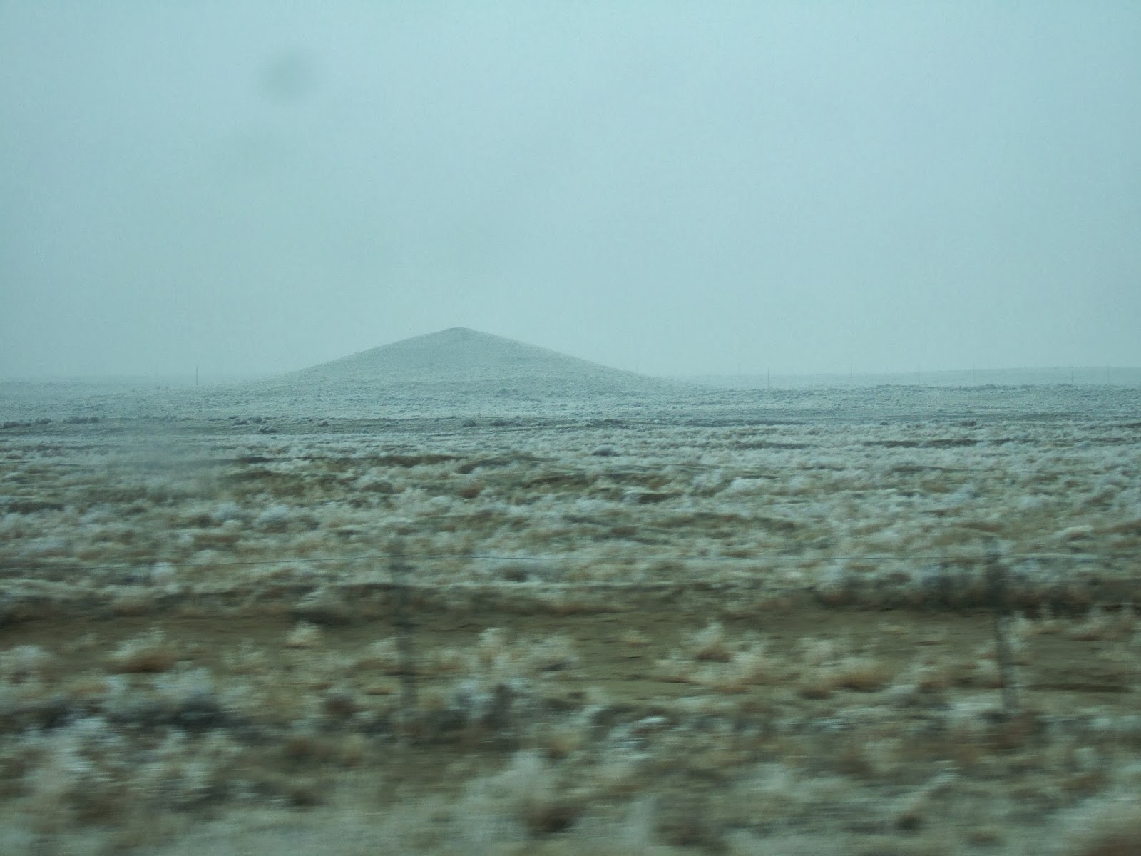
Goose Egg Hill

It was clear enough to see Goose Egg Hill. It is essentially impossible to gage the height of this hill. It rises about 80 feet above the surrounding plain. I have a arm waving theory on it (goose-egg-hill-Hanford).

After a long straight and flat stretch and just past Goose Egg Hill the road rises up a slope. This is the Cold Creek Bar, a deposit of sand and gravel from ice-age floods where the flood waters lost velocity. If you have a sharp eye there are some lumps of boulders on this bar where ice bergs grounded and melted leaving behind boulders from Montana, Idaho and Canada.

The road crosses the top of the Cold Creek Bar and then drops down the very steep and high upstream end of the bar down to the valley floor of the Columbia River and crosses the Columbia at Vernita (no town).

Vernita Bridge and the huge Priest Rapids Bar

Crossing the river the road aims directly at the high Priest Rapids Bar, another deflation gravel bar from the ice-age floods. The gravel bar rises over 300 feet above the river.

Yes, the bar is made of gravel - lots of it

The route then parallels the Columbia with views across the river to the steep north slope of Umtanum Ridge. Rather obscured on this day due to fog, but otherwise a complex slope of faults, folds and large landslides that rises very abruptly 1,800 feet above the river. Umtanum is one of several Yakima Fold Belt ridges.

Umtanum rising into the fog

After miles of crossing the driest part of the state the road enters back into farm land of mostly orchards and vineyards. This area is some of most recent area served by the Columbia Basin project and is fed with water from the Columbia River via the Grande Coulee Dam. Besides the effort to get water to this dry landscape, many of the orchards and vineyards included lots of boulder removal and piles of boulders line the perimeter of a series of orchards and vineyards.

Boulders and apple orchard near Mattawa

The high velocity of the ice-age flood waters is due to the tight narrow constriction at Sentinel Gap where the Columbia River cuts through the Saddle Mountains, a ridge on the northern part of the Yakima Fold Belt.

Remnant gravel bar and steep slopes of Sentinel Gap

View west across Sentinel Gap

The cliffs on the north side of Sentinel Gap are a spectacular mountain cliff front with steep talus rising sharply nearly 2,000 feet above the river.