In the case of the debris flow in Whatcom County, the trigger was a failed stream crossing that held water backed up into a wetland. The failure took place during a rain on snow event. A fairly deep, low elevation snow pack had developed from several weeks of cold and snowy weather. A heavy rain storm then hit the area. This storm was a bit unusual in that it was a fairly cold rain so the areas with rapid snow melt were limited to lower elevations. Numerous landslides impacted the region with a concentrated area in the low mountains of Whatcom County.
The debris flow that blocked the highway was one of the more dramatic slides, but other slides in the area destroyed homes and roads as well. A few days after the debris flow I walked up the drainage to determine the cause. There were reports that recent logging and logging road construction had taken place in the area with the suggestion that this recent activity may have played a role.
The lower drainage just above the fan was very steep with vertical water falls over Chuckanut Formation sandstone. When I reached the recent clear cuts and logging road stream crossings, it was evident that the source of the debris flood was further up the slope. Three logging road stream crossings were destroyed by the debris flow. The source of the debris flow was not very dramatic relative to the impacts. A very old stream crossing in the upper watershed was simply missing. Immediately downstream the debris flows damage began. As the surge of water headed down the stream it picked up more debris and triggered additional erosion and slope failures. In places the debris flow ripped up chunks of bedrock.

Part of the debris deposit

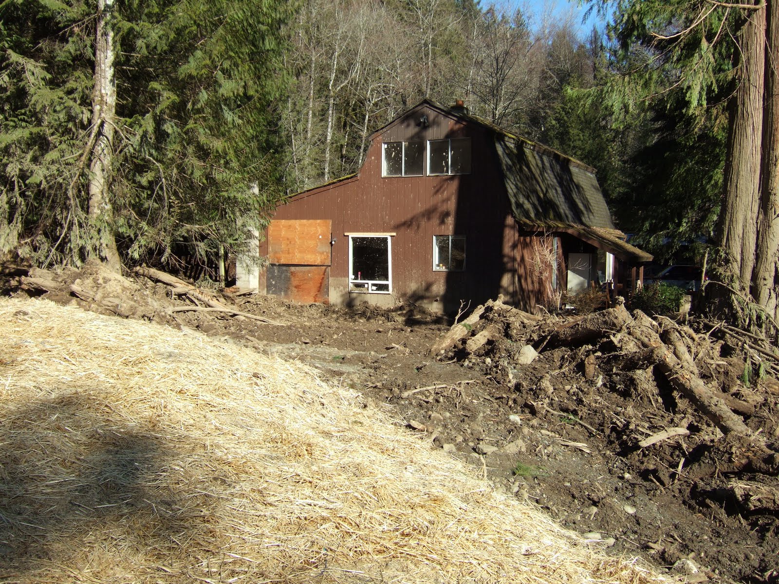
Home hit by debris flow

Trailer damaged by debris
Home hit by debris, note the mud splashes on second story window

Lower logging road crossing

Middle logging road crossing

Trees buried and broken along stream course in a depositional, low gradient reach

Stream stripped down to bedrock

Ripped up bedrock along channel

Source of the trouble, failed stream crossing with road section missing

Just below failure, note height of bark stripped from the western red cedar trunk

Wetland that drained when road crossing failed
Abandoned and forgotten logging road stream crossings have long been identified as a source of stream damaging debris flow events. Steep streams such as this stream in Whatcom County are subject to debris flows. However, the frequency and magnitude of the debris flow events is increased by unnatural dams created by the old crossings. When these road crossings fail, the surge of water and sediment can be enough to create a moving debris flow that will travel all the way to the alluvial fan below. Besides impacts to structures on the alluvial fans, the greater frequency and magnitude of these debris flow events as been identified as a problem for salmon habitat.
In this stream’s case the volume of water behind the crossing was exceptionally large. Based on snow along the margins and on logs within the wetland, I estimated approximately one acre foot of water surged down the stream.


No comments:
Post a Comment